
Stormwater (MS4) Compliance Software
One system to manage inspections, resolve issues, and generate reports across all your MCMs
Managing your MS4 program shouldn’t mean juggling spreadsheets, chasing departments, or scrambling for reports. SwiftComply connects your entire compliance workflow, simplifying data collection, flagging issues early, and generating up-to-date reports as you work.
Trusted by 700+ organizations across North America






Customer stories


Why most systems fall short for MS4 compliance
General compliance systems can be bent to fit MS4 work, but they force workarounds, require duplicate effort, and slow down critical compliance activities.
One-size-fits-all doesn't fit stormwater
Generic tools ignore local permit variations and established workflows. MS4 programs end up twisting their processes to match inflexible software
Scattered data creates blind spots
Inspections, follow-ups and reports live in silos, with no shared view of progress. Tracking tasks becomes guesswork, and proving issue resolution is a time-consuming headache.
Reporting becomes a data hunt
Managing data across spreadsheets, emails, and siloed systems turns reporting into a desperate scramble. Weeks are wasted compiling reports that should be ready in minutes.
Designed to match your MS4 program requirements
Manage your entire program from a central hub, configured to match your local permit requirements, established processes, and terminology. No workarounds required.
Program Management
Program-wide visibility across all Minimum Control Measures
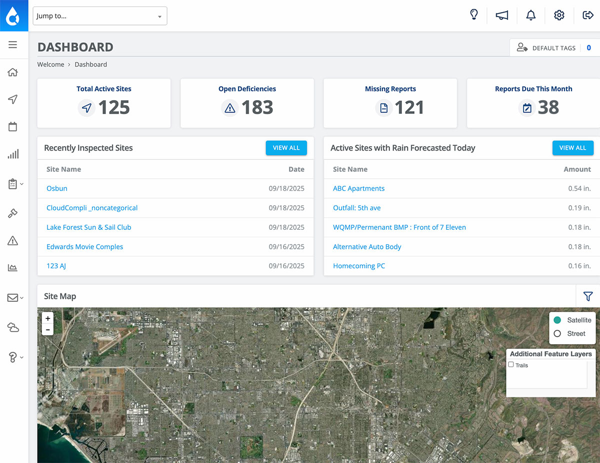
From inspectable programs like construction to activities like good housekeeping, every part of your MS4 program is managed in one system. Configurable modules adapt to your local requirements, so no matter what you track, you always have a complete view across your control measures.
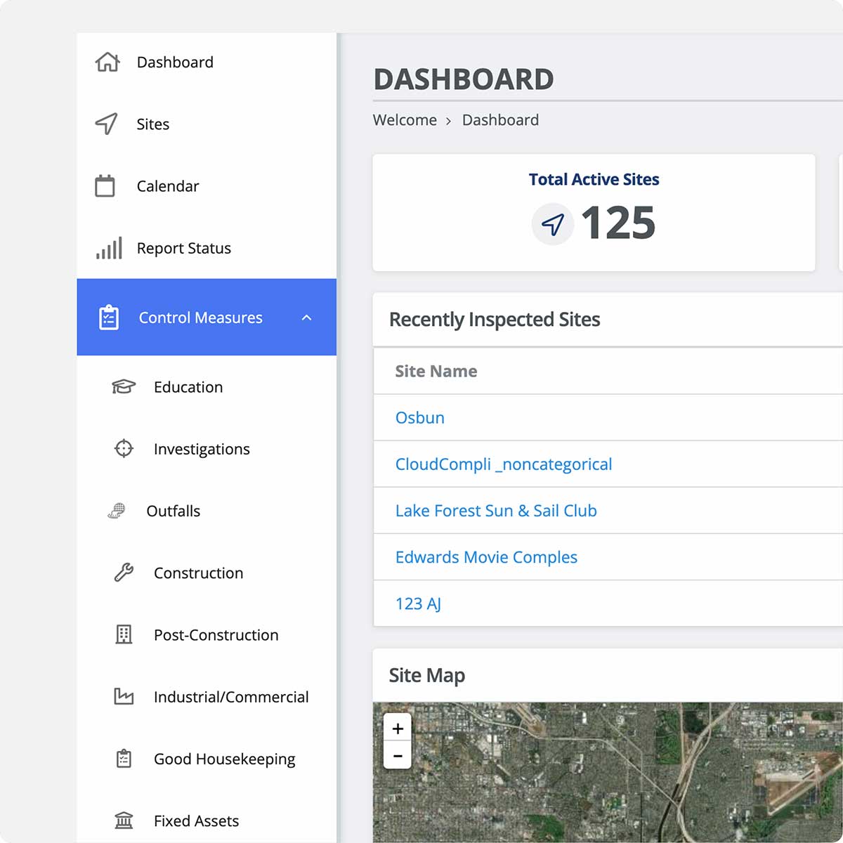
Configure modules to match your program
Turn modules on/off as needed, customize forms, and tailor workflows to your match permit conditions.
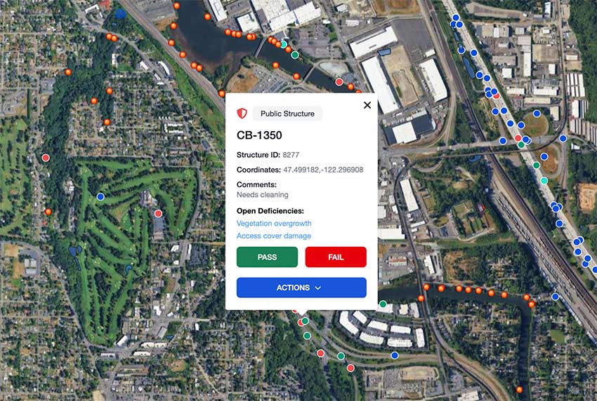
Use shared Esri map as your operational hub
Give every team a live view of sites, issues, and responsibilities. Jump from the map into inspections, notices, and follow-ups.
Track compliance across all programs
See compliance levels and site status in real time. Spot issues early, assign owners, and keep priorities clear.
Inspection Workflows
End-to-end efficiency from permitting to issue resolution
Eliminate the double entry and scattered handoffs that slow down inspection work. Every step, from field inspections to final resolution, is connected in one workflow. This means the work you do in the field becomes the finished report, notice, and compliance record.
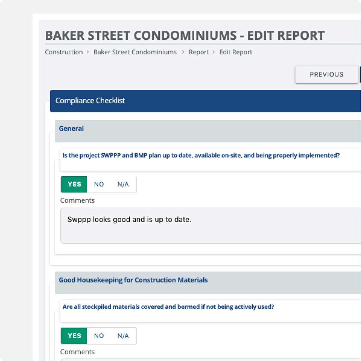
Build or use proven inspection forms
Replicate your existing inspection forms or choose from a library of prebuilt, state-compliant templates to get started fast.
Plan inspections and work offline
Build routes, pre-download sites, and complete inspections with photos, notes, and signatures that sync automatically when you’re back online.
Generate reports & notices instantly
Publish a polished PDF before you leave the site and email targeted deficiency notices in the same step — no office rework required.
Oversight and Enforcement
Close the loop on compliance actions
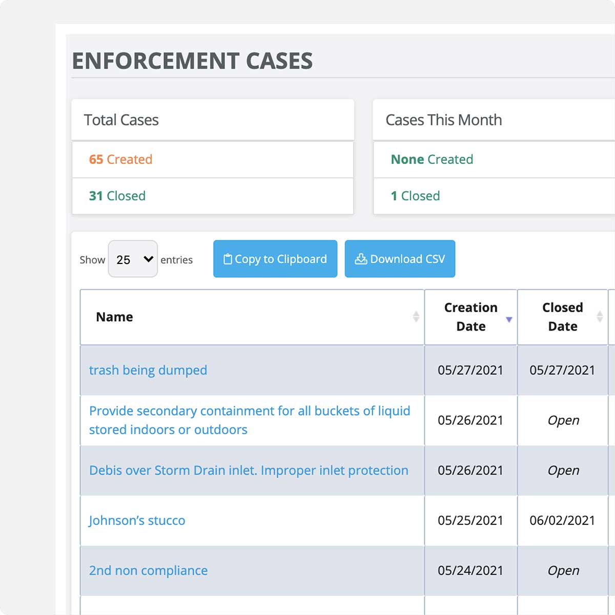
Replace scattered follow-ups with clear accountability. Deficiencies are tracked from identification through resolution, with all communication and documentation in one place.
Send targeted deficiency notices with proof
Email specific issues with attached photos to responsible parties. No recreating reports or hunting through files.
Let stakeholders resolve issues directly
Contractors and property owners upload resolution photos and updates via secure links. Responses are logged automatically.
Track responses and escalate enforcement
See when notices are viewed and receive resolution updates automatically. Escalate to NOVs without leaving the system.
Reporting and Analytics
Automatically turn inspection data into compliance reports
Turn weeks of data hunting into quick report generation. Prebuilt reports pull directly from the data captured across your modules, giving you a real-time view of compliance and making it easy to stay on top of reporting requirements.
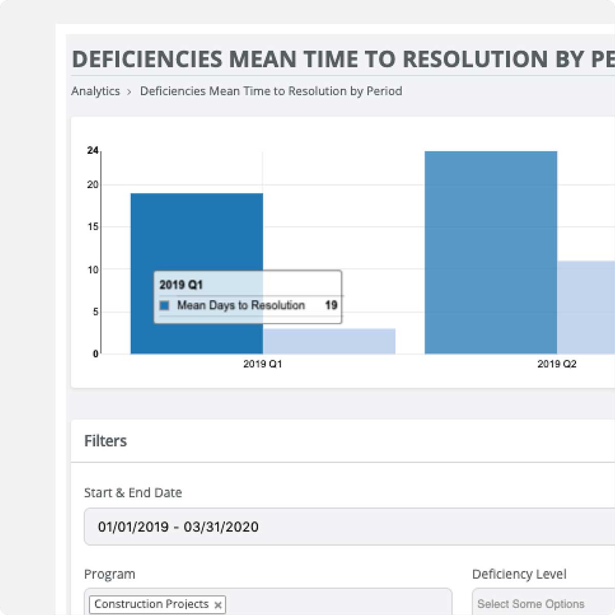
Generate program-specific & custom reports
Run prebuilt reports for each of your minimum control measures, or request custom reports as needed.
Track program status with real-time dashboards
See which sites need attention, what’s overdue, and overall compliance levels at a glance without digging through spreadsheets.
Automatically maintain audit-ready documentation
Every record and action is timestamped and stored with full traceability, so your compliance history builds itself as you work.
GIS integration for mapping and inspections
SwiftComply integrates directly with Esri ArcGIS to connect mapping and compliance data across your city’s programs. Purpose-built for stormwater and supported by open APIs for broader connectivity.
Why MS4 programs choose SwiftComply
Stormwater programs choose SwiftComply because it eliminates workarounds, connects fragmented workflows, and adapts to how their program actually operates.
Complete coverage for MS4 compliance
Purpose-built around the Minimum Control Measures, SwiftComply gives you one system to manage every part of your program.
Configured to match your program
Easily adapt modules, workflows, and terminology so the system fits your requirements — not the other way around.
Helps your team work smarter
Gives your team the time, data, and tools to focus on the areas with the most impact. And resolve issues before they escalate.

SwiftComply Stormwater FAQs
SwiftComply centralizes inspection data, enforcement actions, and public education/outreach tracking that often live in separate departments (engineering, streets, codes) with no shared system, so the person responsible for the annual MS4 report isn't reconstructing it from memory, emails, and multiple spreadsheets.
Conditional logic on inspection forms is supported, allowing an inadequate finding to automatically flag or fail a report rather than relying on an inspector to manually flag every deficiency.
Yes, GIS integration paths exist for common Esri tools; the right approach depends on whether you want SwiftComply to be the system of record or to sync data from an existing field tool. Discuss your current GIS setup with your rep to scope the integration.
No — SwiftComply is used by both mature, large MS4 programs and by utilities standing up a stormwater compliance program for the first time (for example, after crossing an MS4 Phase 2 population threshold). Starting with a system in place before you're required to retrofit historical tracking is generally easier than building a program on spreadsheets first and migrating later.
Some utilities use the platform for related sanitary infrastructure inspections (manholes, pump stations, mains) alongside stormwater tracking — ask your rep whether this fits your specific inspection workflow.
Timelines vary with the number of MCMs configured and the state of existing site/BMP data, but implementations commonly run 6-8 weeks from kickoff to go-live. Programs standing up a stormwater program for the first time with no prior digital records may take longer for initial site inventory than programs migrating from an existing (if imperfect) system.